Geolocate

Nyhammar topographic map

Click on the map to display elevation.

About this map

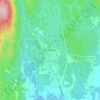
Name: Nyhammar topographic map, elevation, terrain.

Location: Nyhammar, Ludvika kommun, Dalarna County, 770 13, Sweden (60.27257 14.94933 60.31257 14.98933)

Average elevation: 196 m

Minimum elevation: 154 m

Maximum elevation: 358 m

Other topographic maps

Click on a map to view its topography, its elevation and its terrain.

Malung-Sälens kommun

Sweden > Dalarna County

Average elevation: 395 m

Gear up for your next adventure:

🥾Mountain Hiking Shoes - Shoes with superior grip for mountainous terrain
💧Filtered Water Bottle - Safe drinking water on the go
🧰Multitool Knife - Compact and versatile tool for outdoor use
🧥Ultralight Puffy Jacket - Maximum warmth that packs down to the size of an orange
🧢Beanie Hat - Keep your head warm in cold weather

As an Amazon Associate, this site earns from qualifying purchases at no extra cost to you.