
Thônes topographic map
Click on the map to display elevation.
About this map
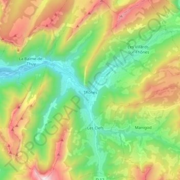
Name: Thônes topographic map, elevation, terrain.
Average elevation: 1,181 m
Minimum elevation: 544 m
Maximum elevation: 2,265 m
Other topographic maps
Click on a map to view its topography, its elevation and its terrain.
Argentière
France > Auvergne-Rhône-Alpes > Upper Savoy > Chamonix-Mont-Blanc
Argentière (French pronunciation: [aʁʒɑ̃tjɛʁ]) is a picturesque skiing, alpine walking and mountaineering village in the French Alps, part of the commune of Chamonix-Mont-Blanc, at an altitude of 1,252 m (4,108 ft).
Average elevation: 1,674 m
Collonges
France > Auvergne-Rhône-Alpes > Upper Savoy > Vétraz-Monthoux > Collonges
Average elevation: 477 m