Geolocate

Mariawa topographic map

Click on the map to display elevation.

About this map
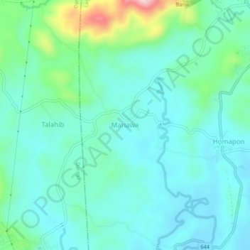
Name: Mariawa topographic map, elevation, terrain.

Location: Mariawa, Legazpi, Albay, Bicol Region, 4500, Philippines (13.07605 123.70478 13.11605 123.74478)

Average elevation: 57 m

Minimum elevation: 4 m

Maximum elevation: 266 m

Other topographic maps

Click on a map to view its topography, its elevation and its terrain.
Mayon Volcano

Philippines > Albay > Legazpi

Average elevation: 519 m

Sawangan Park

Philippines > Albay > Legazpi

Average elevation: 7 m

Kalayaan Park

Philippines > Albay > Legazpi

Average elevation: 7 m

Tibu River

Philippines > Albay > Legazpi > Tamaoyan

Average elevation: 4 m

Gear up for your next adventure:

⛺Tent Footprint - Protect tent floor and increase durability
🥘Camping Cookware Set - Compact nesting pots and pans for trail cooking
🕶️Polarized Sunglasses - Protect your eyes with durable polarized lenses
🕶️Polarized Sunglasses - Reduces glare from snow and water at high elevations
🥾Waterproof Trail Shoes - Shoes designed to handle wet terrain

As an Amazon Associate, this site earns from qualifying purchases at no extra cost to you.