Geolocate

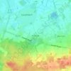
Wettrup topographic map

Click on the map to display elevation.

About this map

Name: Wettrup topographic map, elevation, terrain.

Location: Wettrup, Samtgemeinde Lengerich, Landkreis Emsland, Nedersaksen, Duitsland (52.57240 7.54409 52.61685 7.62265)

Average elevation: 25 m

Minimum elevation: 19 m

Maximum elevation: 38 m

Other topographic maps

Click on a map to view its topography, its elevation and its terrain.

Gleesen

Duitsland > Nedersaksen > Landkreis Emsland

Average elevation: 29 m

Neusustrum

Duitsland > Nedersaksen > Landkreis Emsland

Average elevation: 11 m

Hesselte

Duitsland > Nedersaksen > Landkreis Emsland > Emsbüren

Average elevation: 31 m

Sprakel

Duitsland > Nedersaksen > Landkreis Emsland > Stavern

Average elevation: 39 m

Sand

Duitsland > Nedersaksen > Landkreis Emsland > Oberlangen

Average elevation: 10 m

Haar

Duitsland > Nedersaksen > Landkreis Emsland > Haren (Ems)

Average elevation: 15 m

Gear up for your next adventure:

🥾Hiking Shoes - Durable and comfortable shoes for trail hiking
🥾Mountain Hiking Shoes - Shoes with superior grip for mountainous terrain
💡LED Headlamp - Hands-free illumination for night hiking and camping
🛶Kayak Dry Bag - Waterproof storage for kayaking adventures
🦟Insect Repellent - Keep mosquitoes and black flies away in wooded areas

As an Amazon Associate, this site earns from qualifying purchases at no extra cost to you.