Geolocate

Seymour topographic map

Click on the map to display elevation.

About this map

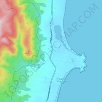
Name: Seymour topographic map, elevation, terrain.

Location: Seymour, Break O'Day, Tasmania, Australia (-41.77081 148.24095 -41.70538 148.30457)

Average elevation: 47 m

Minimum elevation: -1 m

Maximum elevation: 449 m

Gear up for your next adventure:

🧢Hiking Sun Hat - Wide-brimmed protection for exposed mountain ridges
🥾Approach Boots - Comfortable boots for hiking and climbing approaches
🛶Kayak Accessories - Essential gear for safe and fun kayaking adventures
❄️Traction Ice Cleats - Slip-on spikes for icy trails and winter hiking
🛁Quick-Dry Microfiber Towel - Space-saving towel that dries rapidly on the move

As an Amazon Associate, this site earns from qualifying purchases at no extra cost to you.