

Gubitzmoos topographic map
Click on the map to display elevation.
Gubitzmoos
Der Weiler liegt am Kaltenbrunnen, dem rechten Oberlauf der Weides, die ein linker Zufluss der Truppach ist. Im Süden liegt der Gubitzmooswald. Dort befindet sich der Schleifberg (563 m ü. NHN, 1 km südlich), eine Erhebung der nördlichen Fränkischen Schweiz. Der Ort ist von Acker- und Grünland umgeben. 0,5 km nordöstlich liegt die Anhöhe Deutes (502 m ü. NHN). Eine Gemeindeverbindungsstraße führt nach Creez zur Staatsstraße 2163 (1,4 km östlich) bzw. an Voitsreuth und Lenz vorbei nach Schobertsreuth (1,2 km nordwestlich).
About this map
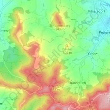
Name: Gubitzmoos topographic map, elevation, terrain.
Average elevation: 473 m
Minimum elevation: 393 m
Maximum elevation: 584 m