Geolocate

Sariaya topographic map

Click on the map to display elevation.

About this map

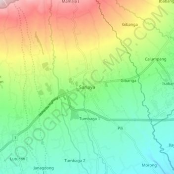
Name: Sariaya topographic map, elevation, terrain.

Location: Sariaya, Quezon, Calabarzon, 4322, Philippines (13.92298 121.48434 14.00298 121.56434)

Average elevation: 210 m

Minimum elevation: 29 m

Maximum elevation: 549 m

Other topographic maps

Click on a map to view its topography, its elevation and its terrain.

Barangay Mamala 2

Philippines > Quezon > Sariaya

Average elevation: 217 m

Poblacion 2

Philippines > Quezon > Sariaya

Average elevation: 206 m

Gear up for your next adventure:

🥘Camping Cookware Set - Compact nesting pots and pans for trail cooking
🧥Softshell Hiking Jacket - The perfect balance of wind protection and breathability
🔥Camping Stove - Portable stoves to cook outdoors with ease
🧥Waterproof Pants - Keep dry during rainy hiking conditions
🎒Fully Waterproof Backpack - Total protection for photography gear and electronics

As an Amazon Associate, this site earns from qualifying purchases at no extra cost to you.