Geolocate

Boxley topographic map

Click on the map to display elevation.

About this map

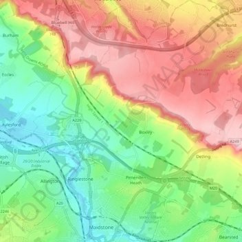
Name: Boxley topographic map, elevation, terrain.

Location: Boxley, Maidstone, Kent, England, United Kingdom (51.27062 0.49249 51.33874 0.58179)

Average elevation: 93 m

Minimum elevation: 3 m

Maximum elevation: 203 m

Gear up for your next adventure:

👖Convertible Hiking Pants - Zip-off legs to adapt to changing weather conditions
🔋Lithium AA Batteries - Long-lasting power that performs in extreme cold
🛶Kayak Accessories - Essential gear for safe and fun kayaking adventures
🧥Fleece Jacket - Warm and lightweight jacket for layering
💡LED Camping Lantern - Illuminate your campsite with long-lasting lanterns

As an Amazon Associate, this site earns from qualifying purchases at no extra cost to you.