
Thank you for supporting this site ❤️
Make a donation
Make a donation
Gear up for your next adventure:
As an Amazon Associate, this site earns from qualifying purchases at no extra cost to you.
Hucuchuy topographic map
Click on the map to display elevation.
Thank you for supporting this site ❤️
Make a donation
Make a donation
Gear up for your next adventure:
As an Amazon Associate, this site earns from qualifying purchases at no extra cost to you.
About this map
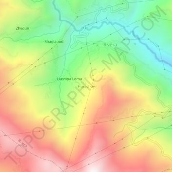
Name: Hucuchuy topographic map, elevation, terrain.
Location: Hucuchuy, Rivera, Azogues, Cañar, Ecuador (-2.60726 -78.67617 -2.56726 -78.63617)
Average elevation: 2,709 m
Minimum elevation: 2,135 m
Maximum elevation: 3,329 m
Thank you for supporting this site ❤️
Make a donation
Make a donation
Gear up for your next adventure:
As an Amazon Associate, this site earns from qualifying purchases at no extra cost to you.