Geolocate

Shakopee topographic map

Click on the map to display elevation.

About this map

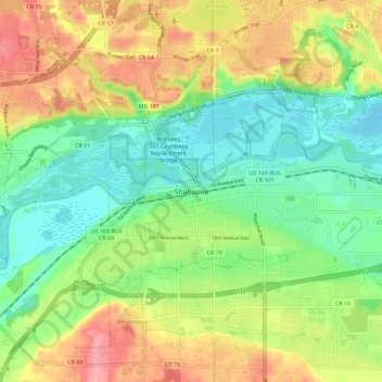
Name: Shakopee topographic map, elevation, terrain.

Location: Shakopee, Scott County, Minnesota, 55379, United States (44.75802 -93.56690 44.83802 -93.48690)

Average elevation: 248 m

Minimum elevation: 208 m

Maximum elevation: 306 m

Gear up for your next adventure:

🦶Hiking Shoe Insoles - Added support for high arches and long days on feet
🥾Hiking Shorts - Breathable shorts suitable for summer hikes
🥽Outdoor Goggles - Protective eyewear for outdoor activities
🧤Thermal Hiking Gloves - Grip-enhanced gloves for cold-weather altitude trekking
🧴Sunscreen SPF - Broad-spectrum sunscreen for outdoor activities

As an Amazon Associate, this site earns from qualifying purchases at no extra cost to you.