Geolocate

Challhuas topographic map

Click on the map to display elevation.

About this map

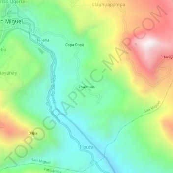
Name: Challhuas topographic map, elevation, terrain.

Location: Challhuas, San Miguel, La Mar, Ayacucho, Perú (-13.04780 -73.98250 -13.00780 -73.94250)

Average elevation: 2,788 m

Minimum elevation: 2,436 m

Maximum elevation: 3,406 m

Gear up for your next adventure:

🧣Merino Neck Gaiter - Protects against wind, sun, and cold at high altitudes
🧦Merino Wool Socks - Moisture-wicking comfort for long-distance hiking
🍽️Titanium Camping Spork - Ultralight and indestructible eating utensil
🏕️Camping Hammock - Integrated protection for sleeping between trees
🧼Travel Hand Sanitizer - Keep hands clean when water is scarce

As an Amazon Associate, this site earns from qualifying purchases at no extra cost to you.