Geolocate

Linares topographic map

Click on the map to display elevation.

About this map
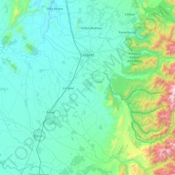
Name: Linares topographic map, elevation, terrain.

Location: Linares, Provincia de Linares, Maule Region, Chile (-36.22591 -71.79700 -35.70333 -71.00628)

Average elevation: 376 m

Minimum elevation: 74 m

Maximum elevation: 2,440 m

Other topographic maps

Click on a map to view its topography, its elevation and its terrain.

Los Pelambres

Chile > Maule Region > Provincia de Linares > Linares

Average elevation: 1,948 m

Gear up for your next adventure:

🔭Compact Binoculars - Lightweight optics for scouting trails and wildlife
🔭Compact Monocular - One-handed bird watching and trail spotting
⛺Camping Tent - Weather-resistant tents suitable for 2 to 6 people
🧥Waterproof Jacket - Lightweight rain jackets for hiking and outdoor activities
⛺Lightweight Camping Tent - Portable shelter optimized for Canadian backcountry camping

As an Amazon Associate, this site earns from qualifying purchases at no extra cost to you.