
Thank you for supporting this site ❤️
Make a donation
Make a donation
Gear up for your next adventure:
As an Amazon Associate, this site earns from qualifying purchases at no extra cost to you.
Cabarroguis topographic map
Click on the map to display elevation.
Thank you for supporting this site ❤️
Make a donation
Make a donation
Gear up for your next adventure:
As an Amazon Associate, this site earns from qualifying purchases at no extra cost to you.
About this map
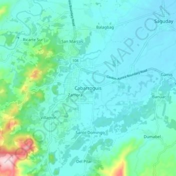
Name: Cabarroguis topographic map, elevation, terrain.
Location: Cabarroguis, Quirino, Cagayan Valley, 3400, Philippines (16.47021 121.48228 16.55021 121.56228)
Average elevation: 157 m
Minimum elevation: 95 m
Maximum elevation: 464 m
Thank you for supporting this site ❤️
Make a donation
Make a donation
Gear up for your next adventure:
As an Amazon Associate, this site earns from qualifying purchases at no extra cost to you.