Geolocate

Tlalchy topographic map

Click on the map to display elevation.

👉 Easily get elevation data in JSON, GeoTIFF and KML formats using Elevation API
Thank you for supporting this site ❤️
Make a donation

About this map

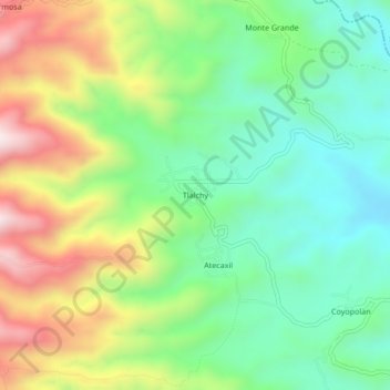
Name: Tlalchy topographic map, elevation, terrain.

Location: Tlalchy, Ixhuacán de los Reyes, Veracruz, Mexico (19.36083 -97.09889 19.40083 -97.05889)

Average elevation: 1,684 m

Minimum elevation: 1,448 m

Maximum elevation: 2,078 m

Gear up for your next adventure:

Backpacking Tent - Lightweight tent for long-distance hiking trips
Lightweight Camping Tent - Portable shelter optimized for Canadian backcountry camping
🩹Compact First Aid Kit - Pre-packed essentials for common trail injuries
🛶Canoe Life Vest - Safety vest for water sports
🛰️Satellite Messenger - Emergency communication for areas with no cell service

As an Amazon Associate, this site earns from qualifying purchases at no extra cost to you.