Geolocate

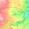
Úvaly topographic map

Click on the map to display elevation.

About this map

Name: Úvaly topographic map, elevation, terrain.

Location: Úvaly, okres Praha-východ, Central Bohemia, 250 82, Czechia (50.05915 14.68914 50.09931 14.75413)

Average elevation: 260 m

Minimum elevation: 214 m

Maximum elevation: 304 m

Other topographic maps

Click on a map to view its topography, its elevation and its terrain.
Talmberg Castle

Czechia > Central Bohemia > Talmberk

Average elevation: 405 m

Bylany

Czechia > Central Bohemia

Average elevation: 323 m

Břve

Czechia > Central Bohemia > Hostivice

Average elevation: 371 m

Mysletice

Czechia > Central Bohemia > Votice

Average elevation: 600 m

Tůmovka

Czechia > Central Bohemia > Předboj

Average elevation: 201 m

Gear up for your next adventure:

🔋Solar Power Bank - Keep your GPS and devices charged during long outdoor trips
🥾Hiking Shoes - Durable and comfortable shoes for trail hiking
🔥Emergency Fire Starter - Reliable ignition source for all weather conditions
🥾Waterproof Trail Shoes - Shoes designed to handle wet terrain
🥘Camping Cookware Set - Compact nesting pots and pans for trail cooking

As an Amazon Associate, this site earns from qualifying purchases at no extra cost to you.