Geolocate

Rat Beach topographic map

Click on the map to display elevation.

About this map

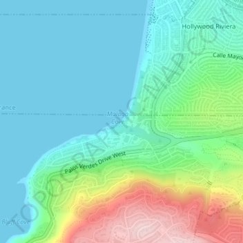
Name: Rat Beach topographic map, elevation, terrain.

Location: Rat Beach, Palos Verdes Estates, Torrance, Los Angeles County, California, United States (33.80291 -118.39706 33.80429 -118.39396)

Average elevation: 70 m

Minimum elevation: 0 m

Maximum elevation: 275 m

Other topographic maps

Click on a map to view its topography, its elevation and its terrain.

Gear up for your next adventure:

🧦Outdoor Socks - Durable socks designed for hiking and outdoor sports
🥤Collapsible Travel Cup - Saves space and weight in your mess kit
🥾Trekking Boots - Durable boots for long-distance trekking
🧤Rechargeable Heated Gloves - Extreme warmth for Canadian winter expeditions
🚲Bike Repair Kit - Essential tools for on-trail mechanical issues

As an Amazon Associate, this site earns from qualifying purchases at no extra cost to you.