
Curepipe topographic map
Interactive map
Click on the map to display elevation.
About this map
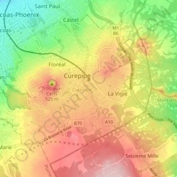
Name: Curepipe topographic map, elevation, terrain.
Location: Curepipe, Plaines Wilhems, Mauritius (-20.34620 57.48768 -20.29328 57.55496)
Average elevation: 536 m
Minimum elevation: 405 m
Maximum elevation: 658 m