Geolocate

Warrenton topographic map

Click on the map to display elevation.

About this map

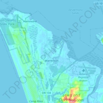
Name: Warrenton topographic map, elevation, terrain.

Location: Warrenton, Clatsop County, Oregon, United States (46.13681 -123.98918 46.20961 -123.85718)

Average elevation: 4 m

Minimum elevation: -4 m

Maximum elevation: 99 m

Other topographic maps

Click on a map to view its topography, its elevation and its terrain.

Westport

United States > Oregon > Clatsop County

Average elevation: 61 m

Tillamook Head

United States > Oregon > Clatsop County

Average elevation: 54 m

Arch Cape

United States > Oregon > Clatsop County

Average elevation: 73 m

Hammond

United States > Oregon > Clatsop County

Average elevation: 3 m

Ecola Point

United States > Oregon > Clatsop County

Average elevation: 33 m

Saddle Mountain

United States > Oregon > Clatsop County

The hike to the taller of the two peaks is a 6-mile (9.7 km) round trip consisting of challenging terrain. Elevation gain is 1,603 feet (489 m) and leads to a 360-degree view to the Pacific Ocean, Cascade Mountain peaks such as Mount Hood, Mount St. Helens, Mount Rainier, Mount Adams, and other peaks in the…

Average elevation: 527 m

Hamlet

United States > Oregon > Clatsop County

Average elevation: 246 m

Hammond

United States > Oregon > Clatsop County

Average elevation: 3 m

Fort Stevens

United States > Oregon > Clatsop County > Hammond

Average elevation: 3 m

Astoria

United States > Oregon > Clatsop County > Astoria

Average elevation: 17 m

Gear up for your next adventure:

👟Trail Running Shoes - Agile footwear for fast-paced topographic exploration
🔋Emergency Crank Radio - Weather alerts and power without needing batteries
🥾Trekking Poles - Adjustable trekking poles to reduce knee stress and improve stability
🚲Handlebar Phone Mount - View topographic-map.com live while cycling
🧦Thermal Socks - Warm socks for winter hiking or camping

As an Amazon Associate, this site earns from qualifying purchases at no extra cost to you.