
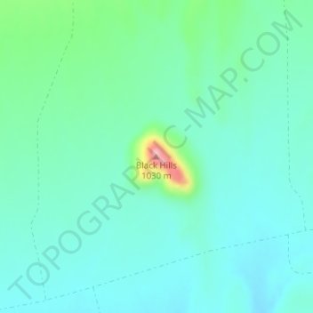
Black Hills topographic map
Interactive map
Click on the map to display elevation.
About this map
Name: Black Hills topographic map, elevation, terrain.
Location: Black Hills, Brewster County, Texas, VS (29.81875 -102.99161 29.81885 -102.99151)
Average elevation: 872 m
Minimum elevation: 838 m
Maximum elevation: 1,008 m
Other topographic maps
Click on a map to view its topography, its elevation and its terrain.
Robinson Ranch
VS > Texas > Robinson Ranch
Robinson Ranch, San Saba County, Texas, VS
Average elevation: 368 m
Wigginsville
VS > Texas > Wigginsville
Wigginsville, Montgomery County, Texas, 77306, VS
Average elevation: 47 m
Olivia Lopez de Gutierrez Colonia
VS > Texas > Olivia Lopez de Gutierrez Colonia
Olivia Lopez de Gutierrez Colonia, Starr County, Texas, 78547, VS
Average elevation: 52 m
North Shore
VS > Texas > North Shore
North Shore, Harris County, Texas, 77339, VS
Average elevation: 21 m