Geolocate

Jardim topographic map

Click on the map to display elevation.

About this map
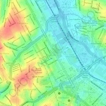
Name: Jardim topographic map, elevation, terrain.

Location: Jardim, Santo André, São Paulo, Região Sudeste, Brasil (-23.65724 -46.54614 -23.63884 -46.52844)

Average elevation: 768 m

Minimum elevation: 741 m

Maximum elevation: 809 m

Other topographic maps

Click on a map to view its topography, its elevation and its terrain.

Grota Funda

Brasil > São Paulo > Santo André > Paranapiacaba

Average elevation: 667 m

J.E.P. Bombas

Brasil > São Paulo > Santo André

Average elevation: 764 m

Gear up for your next adventure:

🥾Trekking Boots - Durable boots for long-distance trekking
🥾Hiking Gaiters - Protect legs and shoes from mud, snow, and debris
🪑Ultralight Camping Stool - Compact seating for rest stops during long hikes
🧢Hiking Hat - Sun-protective and breathable hats for long treks
🔦UV Flashlight - Detect minerals or specific insects in the dark

As an Amazon Associate, this site earns from qualifying purchases at no extra cost to you.