

Make a donation
Gear up for your next adventure:
As an Amazon Associate, this site earns from qualifying purchases at no extra cost to you.
Lovosice topographic map
Click on the map to display elevation.
Make a donation
Gear up for your next adventure:
As an Amazon Associate, this site earns from qualifying purchases at no extra cost to you.
About this map

Name: Lovosice topographic map, elevation, terrain.
Average elevation: 191 m
Minimum elevation: 139 m
Maximum elevation: 544 m
Make a donation
Gear up for your next adventure:
As an Amazon Associate, this site earns from qualifying purchases at no extra cost to you.
Other topographic maps
Click on a map to view its topography, its elevation and its terrain.
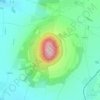
Říp
Czechia > Ústí nad Labem Region > okres Litoměřice > Mnetěš
The name of the mountain is of pre-Slavic origin and probably comes from the Old-Germanic stem ríp- (elevation, hill), which has the Latin parallel in the word rípa (shore, slope, hillside). Some linguists also derive the origin of the name from the Illyrian-Thracian base.
Average elevation: 264 m


Make a donation
Gear up for your next adventure:
As an Amazon Associate, this site earns from qualifying purchases at no extra cost to you.