Geolocate

Crisfield topographic map

Click on the map to display elevation.

About this map

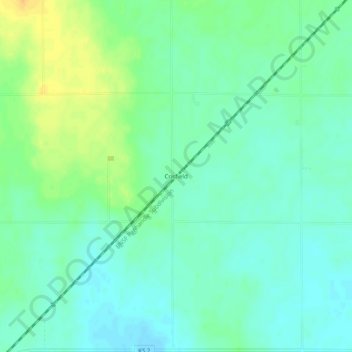
Name: Crisfield topographic map, elevation, terrain.

Location: Crisfield, Harper County, Kansas, United States (37.15225 -98.33146 37.19225 -98.29146)

Average elevation: 413 m

Minimum elevation: 403 m

Maximum elevation: 432 m

Other topographic maps

Click on a map to view its topography, its elevation and its terrain.

Attica

United States > Kansas > Harper County

Average elevation: 445 m

Attica

United States > Kansas > Harper County

Average elevation: 445 m

Gear up for your next adventure:

🧰Multitool Knife - Compact and versatile tool for outdoor use
🥾Approach Shoes - Shoes designed for climbing approaches and rugged trails
🥾Waterproof Hiking Boots - Essential footwear for rugged terrain and wet Canadian trails
📷Outdoor Action Camera - Capture high-elevation views and rugged adventures
🧦Thermal Socks - Warm socks for winter hiking or camping

As an Amazon Associate, this site earns from qualifying purchases at no extra cost to you.