Geolocate

Hadgood topographic map

Click on the map to display elevation.

About this map

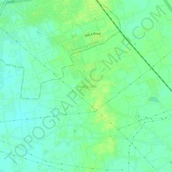
Name: Hadgood topographic map, elevation, terrain.

Location: Hadgood, Anand Rural Taluka, Anand, Gujarat, 388110, India (22.50427 72.95818 22.54427 72.99818)

Average elevation: 42 m

Minimum elevation: 36 m

Maximum elevation: 48 m

Gear up for your next adventure:

🥾Trail Hiking Boots - Supportive boots for rough trails
🧤Rechargeable Heated Gloves - Extreme warmth for Canadian winter expeditions
🔭Outdoor Binoculars - Lightweight binoculars for birdwatching and hiking
🧥Insulated Jacket - Keep warm in cold outdoor conditions
🗺️Topographic Maps - Detailed maps to explore trails, mountains, and wilderness areas

As an Amazon Associate, this site earns from qualifying purchases at no extra cost to you.