
Make a donation
Gear up for your next adventure:
As an Amazon Associate, this site earns from qualifying purchases at no extra cost to you.
6 de Diciembre topographic map
Click on the map to display elevation.
Make a donation
Gear up for your next adventure:
As an Amazon Associate, this site earns from qualifying purchases at no extra cost to you.
About this map
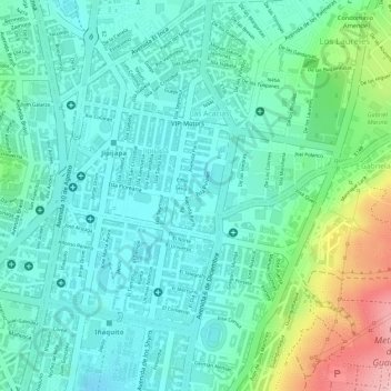
Name: 6 de Diciembre topographic map, elevation, terrain.
Location: 6 de Diciembre, Jipijapa, Quito, Pichincha, Ecuador (-0.17071 -78.47970 -0.16519 -78.47569)
Average elevation: 2,813 m
Minimum elevation: 2,764 m
Maximum elevation: 2,948 m
Make a donation
Gear up for your next adventure:
As an Amazon Associate, this site earns from qualifying purchases at no extra cost to you.
Other topographic maps
Click on a map to view its topography, its elevation and its terrain.
San Francisco de Baños
Ecuador > Pichincha > Quito > La Merced > San Francisco de Baños
Average elevation: 2,596 m
Make a donation
Gear up for your next adventure:
As an Amazon Associate, this site earns from qualifying purchases at no extra cost to you.