Geolocate

Ferrum topographic map

Click on the map to display elevation.

About this map

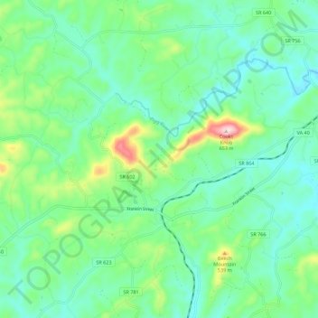
Name: Ferrum topographic map, elevation, terrain.

Location: Ferrum, Franklin County, Virginia, United States (36.90046 -80.06346 36.95598 -79.96096)

Average elevation: 410 m

Minimum elevation: 330 m

Maximum elevation: 659 m

Other topographic maps

Click on a map to view its topography, its elevation and its terrain.

Callaway

United States > Virginia > Franklin County

Average elevation: 398 m

Wirtz

United States > Virginia > Franklin County

Average elevation: 350 m

Gear up for your next adventure:

🗺️Topographic Maps - Detailed maps to explore trails, mountains, and wilderness areas
💧Hydration Bladder - Hands-free hydration solution for long treks
🏃Hydration Running Vest - Carry water and maps close to your body for speed
🔭Compact Monocular - One-handed bird watching and trail spotting
🥾Waterproof Hiking Shoes - Durable shoes for wet and rugged trails

As an Amazon Associate, this site earns from qualifying purchases at no extra cost to you.