Geolocate

lohna topographic map

Click on the map to display elevation.

About this map

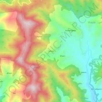
Name: lohna topographic map, elevation, terrain.

Location: lohna, Almora, Uttarakhand, 263637, India (29.71533 79.65918 29.75533 79.69918)

Average elevation: 1,653 m

Minimum elevation: 1,382 m

Maximum elevation: 1,981 m

Gear up for your next adventure:

🧊Insulated Water Bottle - Keeps drinks cold in summer and prevents freezing in winter
🗺️Topographic Maps - Detailed maps to explore trails, mountains, and wilderness areas
🧣Merino Neck Gaiter - Protects against wind, sun, and cold at high altitudes
🧰Survival Kit - Essential gear for emergencies in the wilderness
🥾Trail Hiking Boots - Supportive boots for rough trails

As an Amazon Associate, this site earns from qualifying purchases at no extra cost to you.