Geolocate

Rejano topographic map

Click on the map to display elevation.

About this map
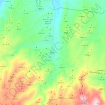
Name: Rejano topographic map, elevation, terrain.

Location: Rejano, Caniles, Comarca de Baza, Granada, Andalucía, España (37.33014 -2.68863 37.37014 -2.64863)

Average elevation: 1,157 m

Minimum elevation: 1,019 m

Maximum elevation: 1,351 m

Gear up for your next adventure:

🔭Outdoor Binoculars - Lightweight binoculars for birdwatching and hiking
🛌Insulated Sleeping Pad - Critical thermal barrier between you and the cold ground
🔥Emergency Fire Starter - Reliable ignition source for all weather conditions
⛺Camping Essentials - All-in-one gear for a comfortable camping trip
🥾Trail Running Shoes - Lightweight and durable shoes for trail running

As an Amazon Associate, this site earns from qualifying purchases at no extra cost to you.