Geolocate

El Faique topographic map

Click on the map to display elevation.

About this map

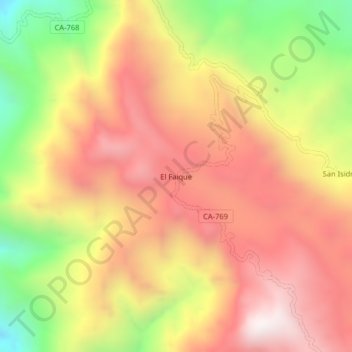
Name: El Faique topographic map, elevation, terrain.

Location: El Faique, Choros, Provincia de Cutervo, Cajamarca, Perú (-5.95495 -78.82755 -5.91495 -78.78755)

Average elevation: 1,484 m

Minimum elevation: 795 m

Maximum elevation: 1,993 m

Gear up for your next adventure:

🛶Canoe Life Vest - Safety vest for water sports
🛏️Sleeping Bag - Warm and compact sleeping bags for outdoor camping
💡Solar Camping Lamp - Eco-friendly lighting for campsites
🕶️Polarized Sunglasses - Protect your eyes with durable polarized lenses
🥾Lightweight Hiking Boots - Boots for comfort and mobility on long hikes

As an Amazon Associate, this site earns from qualifying purchases at no extra cost to you.