Geolocate

Kabacan topographic map

Click on the map to display elevation.

Kabacan

The landscape is characterized by almost regular landscape of flat terrain. The high mountains and rolling hills leaping close to the river plus the narrow plains have varied topographical features. Other features are moderately sloping and strongly sloping.

Wikipedia (CC-BY-SA 3.0)

About this map

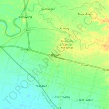
Name: Kabacan topographic map, elevation, terrain.

Location: Kabacan, North Cotabato, Soccsksargen, 9407, Philippines (7.06923 124.78450 7.14923 124.86450)

Average elevation: 21 m

Minimum elevation: 9 m

Maximum elevation: 36 m

Other topographic maps

Click on a map to view its topography, its elevation and its terrain.

Pigcawayan

Philippines > North Cotabato

Average elevation: 133 m

Matalam

Philippines > North Cotabato

Average elevation: 126 m

Makilala

Philippines > North Cotabato

Average elevation: 380 m

New Israel

Philippines > North Cotabato > Makilala

Average elevation: 781 m

Gear up for your next adventure:

🔨Vehicle Emergency Tool - Safety tool for remote road trips to trailheads
💡LED Camping Lantern - Illuminate your campsite with long-lasting lanterns
👟Trail Running Shoes - Agile footwear for fast-paced topographic exploration
💧Collapsible Water Bottle - Space-saving water bottle for outdoor activities
👟Leg Gaiters - Keep debris, mud, and snow out of your boots

As an Amazon Associate, this site earns from qualifying purchases at no extra cost to you.