Geolocate

Mineral topographic map

Click on the map to display elevation.

About this map

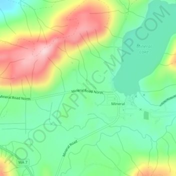
Name: Mineral topographic map, elevation, terrain.

Location: Mineral, Lewis County, Washington, United States (46.71211 -122.19338 46.72677 -122.17191)

Average elevation: 479 m

Minimum elevation: 386 m

Maximum elevation: 640 m

Gear up for your next adventure:

🧰Emergency Multi-Tool - Compact multi-tool for outdoor survival
🥾Hiking Boots - Sturdy boots providing ankle support and traction on rugged trails
👟Trail Running Shoes - Agile footwear for fast-paced topographic exploration
📷Outdoor Action Camera - Capture high-elevation views and rugged adventures
🔦LED Headlamp - Hands-free lighting for early morning starts or late finishes

As an Amazon Associate, this site earns from qualifying purchases at no extra cost to you.