Geolocate

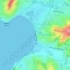
Fullerton Cove topographic map

Click on the map to display elevation.

About this map

Name: Fullerton Cove topographic map, elevation, terrain.

Location: Fullerton Cove, Newcastle-Maitland, Port Stephens Council, New South Wales, 2318, Australia (-32.86703 151.77366 -32.81919 151.87843)

Average elevation: 3 m

Minimum elevation: -3 m

Maximum elevation: 44 m

Other topographic maps

Click on a map to view its topography, its elevation and its terrain.
Gear up for your next adventure:

🧰Multitool Knife - Compact and versatile tool for outdoor use
🧦Outdoor Socks - Durable socks designed for hiking and outdoor sports
🥾Trail Hiking Socks - Comfortable socks to prevent blisters and fatigue
🧣Evaporative Cooling Towel - Beat the heat during intense summer climbs
🧴Waterproofing Spray - Restore the DWR coating on jackets and tents

As an Amazon Associate, this site earns from qualifying purchases at no extra cost to you.