
Thank you for supporting this site ❤️
Make a donation
Make a donation
Gear up for your next adventure:
As an Amazon Associate, this site earns from qualifying purchases at no extra cost to you.
Mehrauli Tehsil topographic map
Click on the map to display elevation.
Thank you for supporting this site ❤️
Make a donation
Make a donation
Gear up for your next adventure:
As an Amazon Associate, this site earns from qualifying purchases at no extra cost to you.
About this map
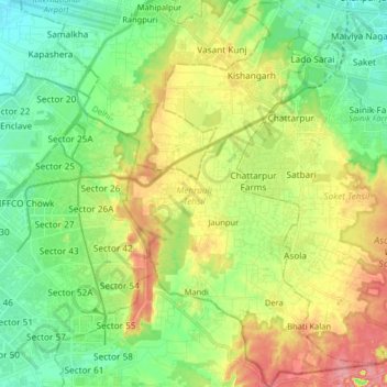
Name: Mehrauli Tehsil topographic map, elevation, terrain.
Location: Mehrauli Tehsil, South Delhi District, Delhi, India (28.40463 77.11247 28.54707 77.22151)
Average elevation: 255 m
Minimum elevation: 218 m
Maximum elevation: 315 m
Thank you for supporting this site ❤️
Make a donation
Make a donation
Gear up for your next adventure:
As an Amazon Associate, this site earns from qualifying purchases at no extra cost to you.