Geolocate

Mehrauli Tehsil topographic map

Click on the map to display elevation.

About this map

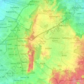
Name: Mehrauli Tehsil topographic map, elevation, terrain.

Location: Mehrauli Tehsil, South Delhi District, Delhi, India (28.40463 77.11247 28.54707 77.22151)

Average elevation: 255 m

Minimum elevation: 218 m

Maximum elevation: 315 m

Gear up for your next adventure:

🎒Hiking Daypack - Lightweight and durable backpacks for day trips and excursions
🩹Moleskin Blister Pads - Direct protection for painful foot pressure points
🧣Merino Neck Gaiter - Protects against wind, sun, and cold at high altitudes
🧢Sun Protection Cap - Breathable cap to protect from sun exposure
🧰Survival Kit - Essential gear for emergencies in the wilderness

As an Amazon Associate, this site earns from qualifying purchases at no extra cost to you.