Geolocate

Eysins topographic map

Click on the map to display elevation.

About this map

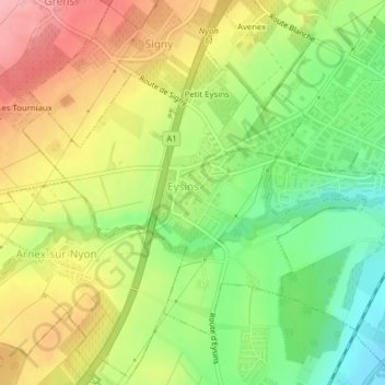
Name: Eysins topographic map, elevation, terrain.

Location: Eysins, District de Nyon, Vaud, 1262, Switzerland (46.37019 6.18787 46.39034 6.22288)

Average elevation: 445 m

Minimum elevation: 385 m

Maximum elevation: 505 m

Other topographic maps

Click on a map to view its topography, its elevation and its terrain.

Gear up for your next adventure:

🔦LED Headlamp - Hands-free lighting for early morning starts or late finishes
🔦LED Headtorch - Bright and durable light for night activities
🥽Outdoor Goggles - Protective eyewear for outdoor activities
🥾Hiking Shorts - Breathable shorts suitable for summer hikes
🥾Mountain Trail Shoes - High-traction shoes for mountain trails

As an Amazon Associate, this site earns from qualifying purchases at no extra cost to you.