
Make a donation
Gear up for your next adventure:
As an Amazon Associate, this site earns from qualifying purchases at no extra cost to you.
Florenceville topographic map
Click on the map to display elevation.
Make a donation
Gear up for your next adventure:
As an Amazon Associate, this site earns from qualifying purchases at no extra cost to you.
Florenceville
The area features a Karst topography. Niagara Cave, located a few miles northeast of the village, is one of the largest caves in the Midwest.
Make a donation
Gear up for your next adventure:
As an Amazon Associate, this site earns from qualifying purchases at no extra cost to you.
About this map
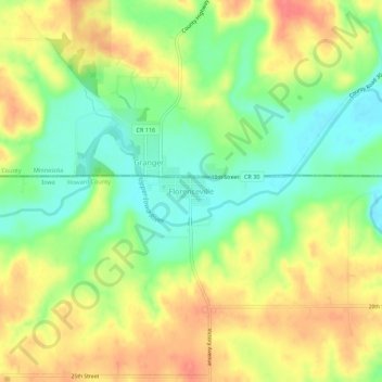
Name: Florenceville topographic map, elevation, terrain.
Location: Florenceville, Howard County, Iowa, 55136, United States (43.47913 -92.15266 43.51913 -92.11266)
Average elevation: 371 m
Minimum elevation: 339 m
Maximum elevation: 405 m
Make a donation
Gear up for your next adventure:
As an Amazon Associate, this site earns from qualifying purchases at no extra cost to you.