
Thank you for supporting this site ❤️
Make a donation
Make a donation
Gear up for your next adventure:
As an Amazon Associate, this site earns from qualifying purchases at no extra cost to you.
Auerbach/Vogtland topographic map
Click on the map to display elevation.
Thank you for supporting this site ❤️
Make a donation
Make a donation
Gear up for your next adventure:
As an Amazon Associate, this site earns from qualifying purchases at no extra cost to you.
About this map
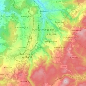
Name: Auerbach/Vogtland topographic map, elevation, terrain.
Location: Auerbach/Vogtland, Vogtlandkreis, Saxony, 08209, Germany (50.44111 12.33176 50.54383 12.49567)
Average elevation: 586 m
Minimum elevation: 408 m
Maximum elevation: 789 m
Thank you for supporting this site ❤️
Make a donation
Make a donation
Gear up for your next adventure:
As an Amazon Associate, this site earns from qualifying purchases at no extra cost to you.
Other topographic maps
Click on a map to view its topography, its elevation and its terrain.