Geolocate

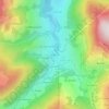
Le Bersend topographic map

Click on the map to display elevation.

About this map

Name: Le Bersend topographic map, elevation, terrain.

Location: Le Bersend, Beaufort, Albertville, Savoie, Auvergne-Rhône-Alpes, France métropolitaine, 73270, France (45.68782 6.55777 45.72782 6.59777)

Average elevation: 1,145 m

Minimum elevation: 691 m

Maximum elevation: 1,863 m

Other topographic maps

Click on a map to view its topography, its elevation and its terrain.

73270

France > Auvergne-Rhône-Alpes > Savoie > Beaufort

Average elevation: 1,597 m

Lac d'Amour

France > Auvergne-Rhône-Alpes > Savoie > Beaufort

Average elevation: 2,328 m

Lac de Roselend

France > Auvergne-Rhône-Alpes > Savoie > Beaufort

Average elevation: 1,681 m

Arêches

France > Auvergne-Rhône-Alpes > Savoie > Beaufort

Il est situé entre 1 025 et 2 281 m. Un télésiège 4-places débrayable construit en 1983 - soit l'un des premiers de ce type en France - part directement depuis le village, et rejoint Le Cuvy (1 710 m). La seule piste noire du sous-domaine est située sous la ligne de montée. Selon le niveau d'enneigement…

Average elevation: 1,235 m

Lac de Roselend

France > Auvergne-Rhône-Alpes > Savoie > Beaufort

Average elevation: 1,681 m

Gear up for your next adventure:

🔭Compact Monocular - One-handed bird watching and trail spotting
🧊Portable Cooler - Keep food and drinks cold during outdoor adventures
👖Convertible Hiking Pants - Zip-off legs to adapt to changing weather conditions
🛰️Satellite Messenger - Emergency communication for areas with no cell service
🛌Down Sleeping Bag - Superior warmth-to-weight ratio for cold nights

As an Amazon Associate, this site earns from qualifying purchases at no extra cost to you.