Geolocate

Kunduran topographic map

Click on the map to display elevation.

About this map

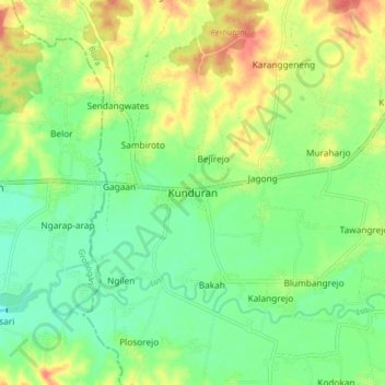
Name: Kunduran topographic map, elevation, terrain.

Location: Kunduran, Blora, Central Java, Java, Indonesia (-7.09167 111.19680 -7.01167 111.27680)

Average elevation: 64 m

Minimum elevation: 42 m

Maximum elevation: 96 m

Other topographic maps

Click on a map to view its topography, its elevation and its terrain.

Bengawan Solo

Indonesia > Central Java > Blora > Kerek > Napel

Average elevation: 65 m

Bengawan Solo

Indonesia > Central Java > Blora > Kerek > Napel

Average elevation: 65 m

Gear up for your next adventure:

🧦Hiking Socks - Moisture-wicking and comfortable socks for long hikes
🥾Hiking Boots - Sturdy boots providing ankle support and traction on rugged trails
🧳Compression Sacks - Maximize space in your backpack by shrinking gear
🦌Outdoor Trail Camera - Monitor wildlife activity near your favorite spots
🍽️Titanium Camping Spork - Ultralight and indestructible eating utensil

As an Amazon Associate, this site earns from qualifying purchases at no extra cost to you.