Geolocate

Akhori topographic map

Click on the map to display elevation.

About this map

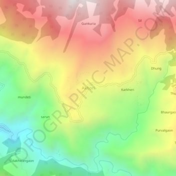
Name: Akhori topographic map, elevation, terrain.

Location: Akhori, Ghansali, Tehri Garhwal, Uttarakhand, India (30.42998 78.73687 30.46998 78.77687)

Average elevation: 1,881 m

Minimum elevation: 1,259 m

Maximum elevation: 2,511 m

Gear up for your next adventure:

🌡️Emergency Mylar Blankets - Compact thermal protection for unexpected nights outdoors
🛁Quick-Dry Microfiber Towel - Space-saving towel that dries rapidly on the move
🥽Outdoor Goggles - Protective eyewear for outdoor activities
🥾Mountain Trail Shoes - High-traction shoes for mountain trails
👖Convertible Hiking Pants - Zip-off legs to adapt to changing weather conditions

As an Amazon Associate, this site earns from qualifying purchases at no extra cost to you.