
Thank you for supporting this site ❤️
Make a donation
Make a donation
Gear up for your next adventure:
As an Amazon Associate, this site earns from qualifying purchases at no extra cost to you.
Brussa topographic map
Click on the map to display elevation.
Thank you for supporting this site ❤️
Make a donation
Make a donation
Gear up for your next adventure:
As an Amazon Associate, this site earns from qualifying purchases at no extra cost to you.
About this map
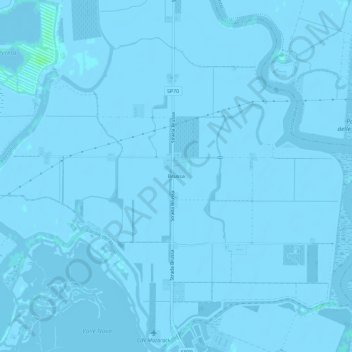
Name: Brussa topographic map, elevation, terrain.
Location: Brussa, Caorle, Venezia, Veneto, 30021, Italië (45.63710 12.92788 45.67710 12.96788)
Average elevation: -2 m
Minimum elevation: -9 m
Maximum elevation: 6 m
Thank you for supporting this site ❤️
Make a donation
Make a donation
Gear up for your next adventure:
As an Amazon Associate, this site earns from qualifying purchases at no extra cost to you.