Geolocate

Venray topographic map

Click on the map to display elevation.

About this map

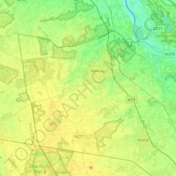
Name: Venray topographic map, elevation, terrain.

Location: Venray, Limburg, Netherlands (51.44656 5.83824 51.57024 6.14109)

Average elevation: 26 m

Minimum elevation: 9 m

Maximum elevation: 49 m

Other topographic maps

Click on a map to view its topography, its elevation and its terrain.

Maastricht

Netherlands > Limburg > Maastricht

Average elevation: 101 m

Gear up for your next adventure:

🚲MTB Frame Bag - Carry tools and maps directly on your bicycle frame
🧥Insulated Jacket - Keep warm in cold outdoor conditions
🦟Insect Repellent - Keep mosquitoes and black flies away in wooded areas
🧴First Aid Kit - Essential first aid supplies for outdoor emergencies
🧊Insulated Water Bottle - Keeps drinks cold in summer and prevents freezing in winter

As an Amazon Associate, this site earns from qualifying purchases at no extra cost to you.