Geolocate

Dharkot topographic map

Click on the map to display elevation.

About this map

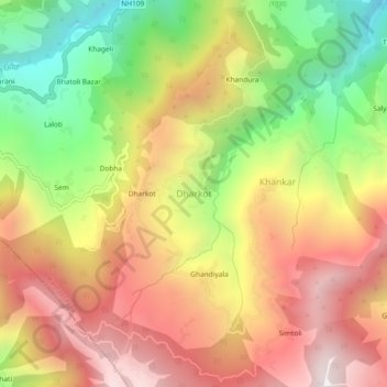
Name: Dharkot topographic map, elevation, terrain.

Location: Dharkot, Karnaprayag, Chamoli, Uttarakhand, 246440, India (30.16030 79.23395 30.20030 79.27395)

Average elevation: 1,550 m

Minimum elevation: 875 m

Maximum elevation: 2,152 m

Other topographic maps

Click on a map to view its topography, its elevation and its terrain.

Ghandiyal

India > Uttarakhand > Karnaprayag

Average elevation: 1,748 m

Gear up for your next adventure:

🔋Solar Power Bank - Keep your GPS and devices charged during long outdoor trips
🪑Insulated Seat Pad - Protect your seat from cold rocks and wet logs
🧥Softshell Jacket - Windproof and breathable jacket for hiking
🥾Trekking Boots - Durable boots for long-distance trekking
🧥Waterproof Hiking Jacket - Protect yourself from rain and wind while hiking

As an Amazon Associate, this site earns from qualifying purchases at no extra cost to you.