Geolocate

Sarreguemines topographic map

Click on the map to display elevation.

About this map
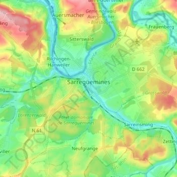
Name: Sarreguemines topographic map, elevation, terrain.

Location: Sarreguemines, Moselle, Grand Est, Metropolitan France, 57200, France (49.07965 7.00571 49.13238 7.13617)

Average elevation: 243 m

Minimum elevation: 191 m

Maximum elevation: 340 m

Other topographic maps

Click on a map to view its topography, its elevation and its terrain.

Winter Peters Etzel

France > Grand Est > Moselle > Rémering

Average elevation: 285 m

Gear up for your next adventure:

⛺Backpacking Tent - Lightweight tent for long-distance hiking trips
🧭Orienteering Kit - Tools for map reading and navigation in the wild
🥾Mountaineering Boots - Supportive boots for climbing and high-altitude hiking
🧥Insulated Jacket - Keep warm in cold outdoor conditions
🧥Softshell Hiking Jacket - The perfect balance of wind protection and breathability

As an Amazon Associate, this site earns from qualifying purchases at no extra cost to you.