
Mungalup topographic map
Interactive map
Click on the map to display elevation.
About this map
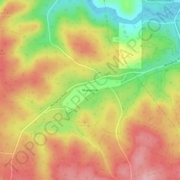
Name: Mungalup topographic map, elevation, terrain.
Location: Mungalup, Bunbury, Western Australia, Australia (-33.41594 116.08344 -33.37594 116.12344)
Average elevation: 266 m
Minimum elevation: 174 m
Maximum elevation: 338 m