
Make a donation
Gear up for your next adventure:
As an Amazon Associate, this site earns from qualifying purchases at no extra cost to you.
Auleben topographic map
Click on the map to display elevation.
Make a donation
Gear up for your next adventure:
As an Amazon Associate, this site earns from qualifying purchases at no extra cost to you.
Auleben
Südlich und südwestlich des Dorfes erhebt sich die Windleite. Im Norden erstreckt sich die große Tiefebene der Goldenen Aue, nördlich davon kann man in der Ferne die Höhen des Harzes und Alten Stolberg erkennen. Im Südosten erhebt sich die Badraer Schweiz, welche den Übergang zwischen dem Kyffhäusergebirge und der Windleite darstellt.
Make a donation
Gear up for your next adventure:
As an Amazon Associate, this site earns from qualifying purchases at no extra cost to you.
About this map
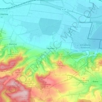
Name: Auleben topographic map, elevation, terrain.
Average elevation: 216 m
Minimum elevation: 152 m
Maximum elevation: 369 m
Make a donation
Gear up for your next adventure:
As an Amazon Associate, this site earns from qualifying purchases at no extra cost to you.
Other topographic maps
Click on a map to view its topography, its elevation and its terrain.