Geolocate

Burgos topographic map

Click on the map to display elevation.

About this map

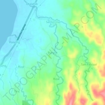
Name: Burgos topographic map, elevation, terrain.

Location: Burgos, Casiguran, Sorsogon, Bicol Region, Philippines (12.86389 124.02289 12.90389 124.06289)

Average elevation: 30 m

Minimum elevation: -1 m

Maximum elevation: 103 m

Gear up for your next adventure:

🧦Thermal Socks - Warm socks for winter hiking or camping
🧭GPS Tracker - Track your location in remote areas safely
🌡️Emergency Mylar Blankets - Compact thermal protection for unexpected nights outdoors
🦶Hiking Shoe Insoles - Added support for high arches and long days on feet
👟Sport Hiking Sandals - Breathable footwear for water crossings and camp rest

As an Amazon Associate, this site earns from qualifying purchases at no extra cost to you.