Geolocate

Bagong Silang topographic map

Click on the map to display elevation.

About this map

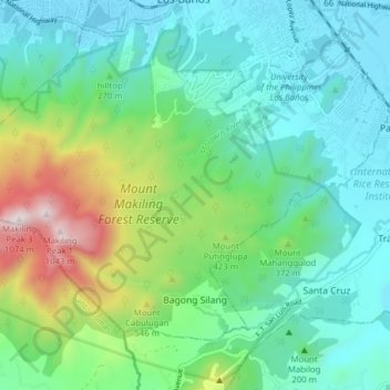
Name: Bagong Silang topographic map, elevation, terrain.

Location: Bagong Silang, Los Baños, Laguna, Calabarzon, Philippines (14.11133 121.17134 14.16755 121.24935)

Average elevation: 270 m

Minimum elevation: 5 m

Maximum elevation: 1,076 m

Other topographic maps

Click on a map to view its topography, its elevation and its terrain.

Mount Makiling

Philippines > Laguna > Los Baños

Average elevation: 327 m

Gear up for your next adventure:

🛏️Sleeping Bag - Warm and compact sleeping bags for outdoor camping
🔭Compact Binoculars - Lightweight optics for scouting trails and wildlife
🧥Packable Rain Jacket - Breathable waterproof layer for unpredictable weather
🧥Ultralight Puffy Jacket - Maximum warmth that packs down to the size of an orange
💡Solar Camping Lamp - Eco-friendly lighting for campsites

As an Amazon Associate, this site earns from qualifying purchases at no extra cost to you.