Geolocate

Fairplay topographic map

Click on the map to display elevation.

About this map

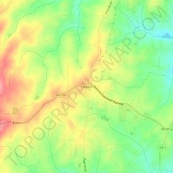
Name: Fairplay topographic map, elevation, terrain.

Location: Fairplay, Douglas County, Georgia, United States (33.60344 -84.87994 33.64344 -84.83994)

Average elevation: 330 m

Minimum elevation: 276 m

Maximum elevation: 390 m

Gear up for your next adventure:

🧥Packable Rain Jacket - Breathable waterproof layer for unpredictable weather
🧦Crew Hiking Socks - Comfortable socks for long-distance hikes
Camping Groundsheet - Protect your tent from moisture and dirt
🌬️Windproof Camp Stove - Efficient cooking even on exposed mountain peaks
🚲Bike Repair Kit - Essential tools for on-trail mechanical issues

As an Amazon Associate, this site earns from qualifying purchases at no extra cost to you.