
Make a donation
Gear up for your next adventure:
As an Amazon Associate, this site earns from qualifying purchases at no extra cost to you.
Cerro de Los Potrerillos topographic map
Click on the map to display elevation.
Make a donation
Gear up for your next adventure:
As an Amazon Associate, this site earns from qualifying purchases at no extra cost to you.
About this map
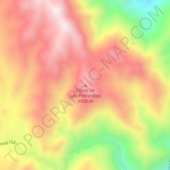
Name: Cerro de Los Potrerillos topographic map, elevation, terrain.
Average elevation: 2,852 m
Minimum elevation: 2,460 m
Maximum elevation: 3,113 m
Make a donation
Gear up for your next adventure:
As an Amazon Associate, this site earns from qualifying purchases at no extra cost to you.
Other topographic maps
Click on a map to view its topography, its elevation and its terrain.
Parque Provincial Aconcagua
Argentina > Mendoza > Distrito Uspallata
El cerro Aconcagua está situado en extremo sur de la cadena denominada los Penitentes, y con sus 6960,8 msnm, se lleva el atributo del ser la mayor elevación del mundo fuera del sistema de los Himalayas. Su gran altura, como la de otros cerros próximos, no corresponde a estructuras volcánicas activas…
Average elevation: 4,167 m
Make a donation
Gear up for your next adventure:
As an Amazon Associate, this site earns from qualifying purchases at no extra cost to you.