
Thank you for supporting this site ❤️
Make a donation
Make a donation
Gear up for your next adventure:
As an Amazon Associate, this site earns from qualifying purchases at no extra cost to you.
Fourmile topographic map
Click on the map to display elevation.
Thank you for supporting this site ❤️
Make a donation
Make a donation
Gear up for your next adventure:
As an Amazon Associate, this site earns from qualifying purchases at no extra cost to you.
About this map
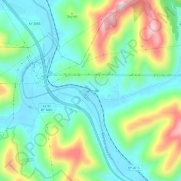
Name: Fourmile topographic map, elevation, terrain.
Location: Fourmile, Bell County, Kentucky, 40939, United States (36.77342 -83.76186 36.81342 -83.72186)
Average elevation: 406 m
Minimum elevation: 295 m
Maximum elevation: 648 m
Thank you for supporting this site ❤️
Make a donation
Make a donation
Gear up for your next adventure:
As an Amazon Associate, this site earns from qualifying purchases at no extra cost to you.
Other topographic maps
Click on a map to view its topography, its elevation and its terrain.
Pine Mountain State Resort Park
United States > Kentucky > Bell County > Pineville
Average elevation: 489 m